Ettringen | |
|---|---|
 Ettringen seen from the southeast | |
 Coat of arms | |
Location of Ettringen within Mayen-Koblenz district 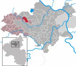 | |
  Ettringen  Ettringen | |
| Coordinates: 50°21′32″N 7°13′17″E / 50.35889°N 7.22139°E | |
| Country | Germany |
| State | Rhineland-Palatinate |
| District | Mayen-Koblenz |
| Municipal assoc. | Vordereifel |
| Government | |
| • Mayor (2019–24) | Werner Spitzley[1] (CDU) |
| Area | |
| • Total | 9.16 km2 (3.54 sq mi) |
| Elevation | 400 m (1,300 ft) |
| Population (2021-12-31)[2] | |
| • Total | 2,767 |
| • Density | 300/km2 (780/sq mi) |
| Time zone | UTC+01:00 (CET) |
| • Summer (DST) | UTC+02:00 (CEST) |
| Postal codes | 56729 |
| Dialling codes | 02651 |
| Vehicle registration | MYK |
| Website | www.ettringen-eifel.de |
Ettringen is a municipality in the district of Mayen-Koblenz in Rhineland-Palatinate, western Germany.
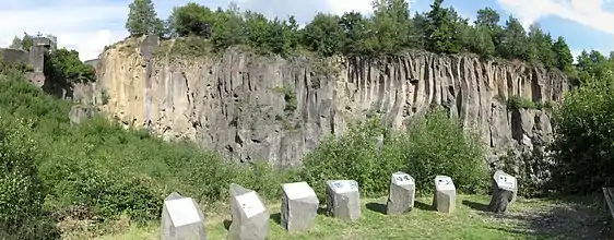
The nearby abandoned stone quarry Ettringer Lay serves as a popular climbing area of the German Alpine Club (DAV) with more than 790 routes set in the basalt walls.[3][4]
References
- ↑ Direktwahlen 2019, Landkreis Mayen-Koblenz, Landeswahlleiter Rheinland-Pfalz, accessed 5 August 2021.
- ↑ "Bevölkerungsstand 2021, Kreise, Gemeinden, Verbandsgemeinden" (in German). Statistisches Landesamt Rheinland-Pfalz. 2022.
- ↑ "Ettringer Lay". theCrag. Archived from the original on August 1, 2019. Retrieved August 1, 2019.
- ↑ "Klettern "Ettringer Lay" und "Kottenheimer Winfeld"". Eifel. Archived from the original on Aug 1, 2019.

This article is issued from Wikipedia. The text is licensed under Creative Commons - Attribution - Sharealike. Additional terms may apply for the media files.